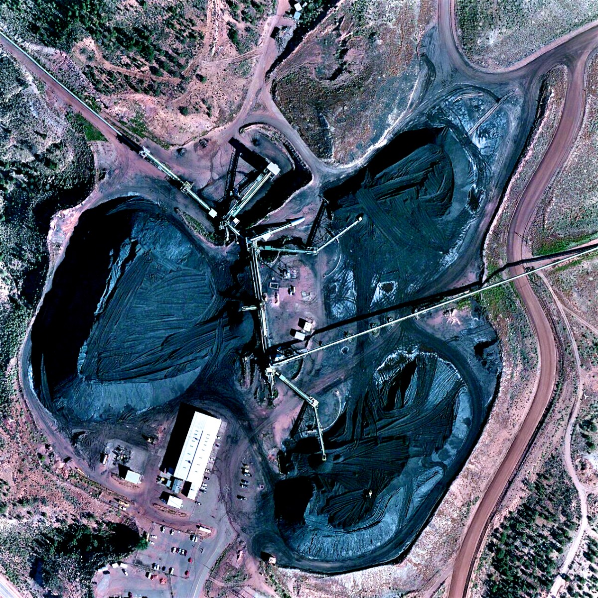
Late in 2017 the Central Arizona Project and the other owners of the NGS announce that the Navajo Generating Station would be decommissioned in 2019. The coal mine will close, Navajo jobs at NGS and the Black Mesa mine, and tribal royalty revenues will be lost. Negotiations are underway between all parties as to what happens next to the land and the infrastructure of NGS and the Black Mesa coal mines. One chapter comes to a close, and another begins.
Black Heart is a part of an ongoing artistic exploration of the human relationship to the landscape of the Southwestern United States. This undertaking has included traditional photography, the framing of imagery from orthomosaic maps, drawing, and development of online environments. This exploration has taken me to many locations in the Southwest including: Chaco Canyon, the canyons and dams of the Colorado River, The Native American homelands in New Mexico and Arizona, and Death Valley.
I grew up in the desert Southwest and I have a special affinity this place. It is unique, with majestic landscapes, ancient ruins, and a rich culture that blends influences of the American Indian, the Spanish, and the European settlers of the United States. It holds the largest communities of native peoples in the United States, it also holds the largest concentration of military activity. The landscape has a monumental scale, and so do the human interventions: the Great Houses of Chaco Canyon, The Pacific Railroad, Hoover Dam, the Nevada Test Site, the Central Arizona Project….
The imagery in Black Heart is derived from orthomosaic maps. The best know example of an orthomosaic map is Google Maps satellite view, which is really more of a computer system than what we would traditionally think of as a map. Orthomosaics are created from many (tens to millions, depending on the area covered and resolution) overlapping aerial photographic images, which are processed to create a dimensionally accurate, geo-referenced tiles in multiple scales. The software user interface then allows for traversing the tiles in three axis. Because new imagery is constantly becoming available, snd the demand for current views of the earth’s surface, online orthomosaic maps are in a constant state of change. The tiles in Black Heart are individual framed views of a particular orthomosaic map that provides a background for mapping in the GIS application ArcGIS, which is used to create analytical maps for science, business and government. The images are captured on the screen and then manipulated in Adobe Photoshop. I consider them to be photographs of a human digital artifact.
The primary text, accessed through the digital portals (QR codes) in the artwork, provide a contextual narrative for the physical visual work. If you are interested in learning more, click the “Dig Deeper” button at the bottom of each screen to view links to additional online resources that I have discovered in the course of my research for this project.
Connecting with the artist. If you are interested, please visit the Connecting page of my web site.
David Alan Boyd
January 2018